Science & Tools Library
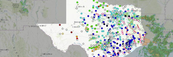
Near Real-Time Maps
Near real-time maps provide information from sensors like weather conditions, water levels or road conditions. This collections of maps includes weather sensors (rainfall, soil moisture and wind conditions), river gages, lake levels, road conditions and flooding scenarios. These maps are designed to help you assess current conditions across the state.
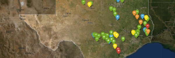
TxGIO Flood Viewer
Texas Geographic Information Office (TxGIO) Flood Viewer displays lake levels, river heights, and other real time weather conditions across Texas. You can subscribe and set up notifications that will alert you when water is rising in a river near your house or property.
TWDB TexMesonet
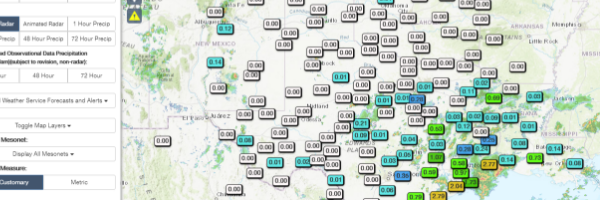
Texas Water Development Board TexMesonet displays real time and seasonal data from weather stations across the state including precipitation, soil moisture, and other measurements.
Flood Decision Support Toolbox
Interagency Flood Risk Management (InFRM) Flood Decision Support Toolbox shows real-time weather information and includes the estimated depth of water in hypothetical flooding scenarios. You can answer questions like “Will my house flood if a flood event causes the Colorado River to rise 10ft?”
Drive Texas
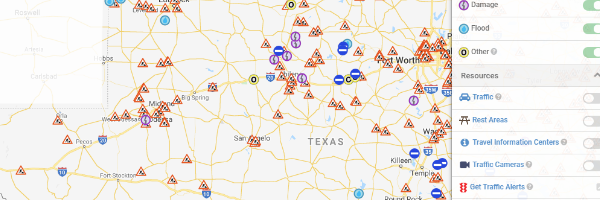
Texas Department of Transportation (TxDOT) DriveTexas provides verified, real-time highway conditions across Texas. It shows useful day-to-day information like traffic conditions, areas with construction, and road closures. Most importantly, it has information that is critical during emergencies, such as contraflow planning for evacuations. You can sign up for customized traffic alerts for routes you regularly travel.
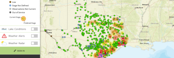
USGS Texas Water Dashboard
US Geologic Survey (USGS) Texas Water Dashboard shows the information that you can find on the TXGIO Flood Viewer and more information that scientists use to study weather and climate patterns. Information about river height, or stage, as well as river velocity, and water quality are available. In addition to rivers, information is also collected from lakes, wells, and rain gages. Information about weather hazards, rainfall, and cloud cover is also available. Station cameras show pictures of current conditions at data collection points along rivers around Texas.
Long-term Information
There are different ways to calculate flood risk, and each has its advantages and disadvantages. As a result, different models can show different results. Looking at the following maps can provide a more holistic understanding of your flood risk.
Texas Flood Hazard Quilt
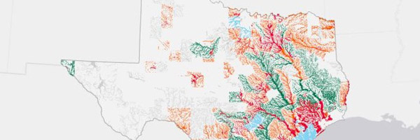
The Texas Water Development Board Texas Floodplain Quilt is a collection of flood risk spatial data from various sources that are “quilted” together by prioritizing the highest quality data layer available in each area of the state. The Floodplain Quilt denotes the 1-percent and 0.2-percent-annual-chance floodplains, where available. To download the GIS data from the quilt visit the Texas Flood Planning Data Hub.
FEMA Estimated Base Flood Elevation
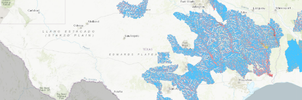
FEMA (Federal Emergency Management Agency) Estimated Base Flood Elevation depicts water depths and flood extents for the 1% annual chance flood or “100-year flood” that are estimated using Base Level Engineering analyses. BLE is the first step to developing an official FEMA Flood Insurance Rate Map, so the information on this website will include areas that may not be included on the National Flood Hazard Layer and in some areas can be considered the best available data.
FEMA National Flood Hazard Layer
FEMA (Federal Emergency Management Agency) National Flood Hazard Layer shows the official FEMA Flood Insurance Rate Maps that are used to set insurance rates and establish building and land use regulations. These maps are updated regularly, but the process can be lengthy. Texas is a large state, so not all areas of Texas have been mapped. Also, some areas have experienced major population growth and land use changes since the area was lasted studied, and those changes can affect where and when it floods. Looking at other available floodplain maps can give a more complete understanding of your flood risk.
Flood Factor

First Street's - Flood Factor allows you to see your potential flood risk. This map is created by the nonprofit First Street Foundation. While this is a helpful tool, it is not used for determining flood insurance requirements and should be used in conjunction with the FEMA National Flood Hazard Layer. If you have questions about floodplain regulations, it is always a good idea to talk to your community’s Floodplain Administrator (FPA).